Design Automation Lab
The Möbius Ecosystem
A web-based ecosystem for parametric modelling.
Möbius Modeller
Möbius Modeller is at the core of the Möbius Ecosystem.
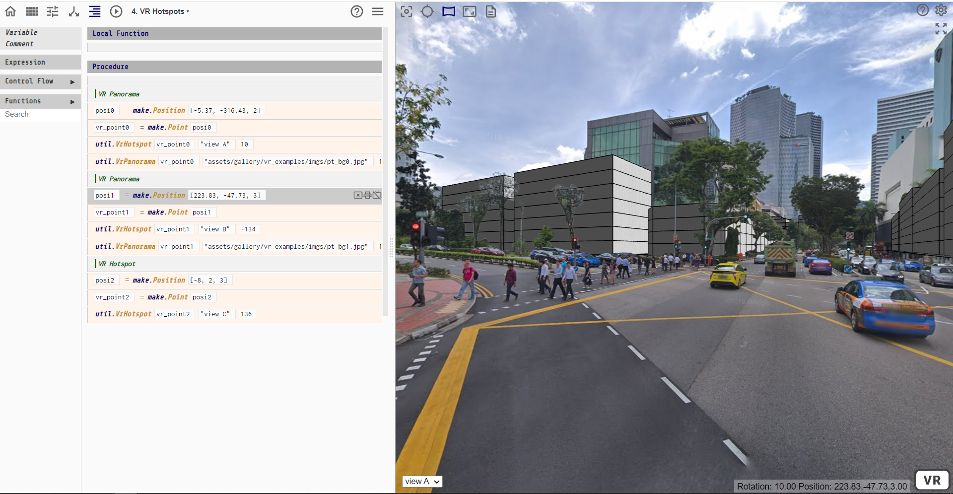
Möbius Modeller is an open-source web application for parametric modelling. The app allows users to create modelling procedures using visual programming techniques, combining flowcharts with drag-and-drop fill-in-the-blanks coding. The models can be published as interactive web pages, allowing visitors on the web to explore the models.
Versions
Current stable version:
Next version (under development, not stable):
Previous versions:
- Möbius Modeller Version 0.7.5
- Möbius Modeller Version 0.6.3
- Möbius Modeller Version 0.5.77
- Möbius Modeller Version 0.5.6
- Möbius Modeller Version 0.5.48
- Möbius Modeller Version 0.4.34
- Möbius Modeller Version 0.4.30
- Möbius Modeller Version 0.4.26
- Möbius Modeller Version 0.4.18
- Möbius Modeller Version 0.4.11
- Möbius Modeller Version 0.3
- Möbius Modeller Version 0.2
- Möbius Modeller Version 0.1
Source Code
Source code is available on Github.
- Lead Developer (2018 - ongoing): Tung Do Phuong Bui
- Lead Developer (2017 - 2018): Akshata Mohanty
-
Lead Developer (2015 - 2016): Ruize Li
- Möbius Modeller Version 0.7.5
- Möbius Modeller Version 0.6.3
- Möbius Modeller Version 0.5.77
- Möbius Modeller Version 0.5.6
- Möbius Modeller Version 0.5.48
- Möbius Modeller Version 0.4.34
- Möbius Modeller Version 0.4.30
- Möbius Modeller Version 0.4.26
- Möbius Modeller Version 0.4.18
- Möbius Modeller Version 0.4.11
- Möbius Modeller Version 0.3
- Möbius Modeller Version 0.2
- Möbius Modeller Version 0.1
History
The history of Möbius Modeller.
Möbius Geospatial Modeller, version 0.3.x
The Möbius Geospatial Modeller was developed between 2017 and 2018.
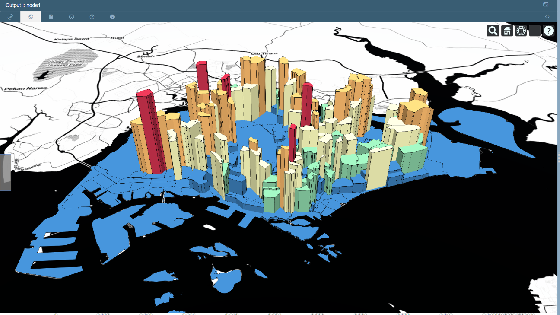
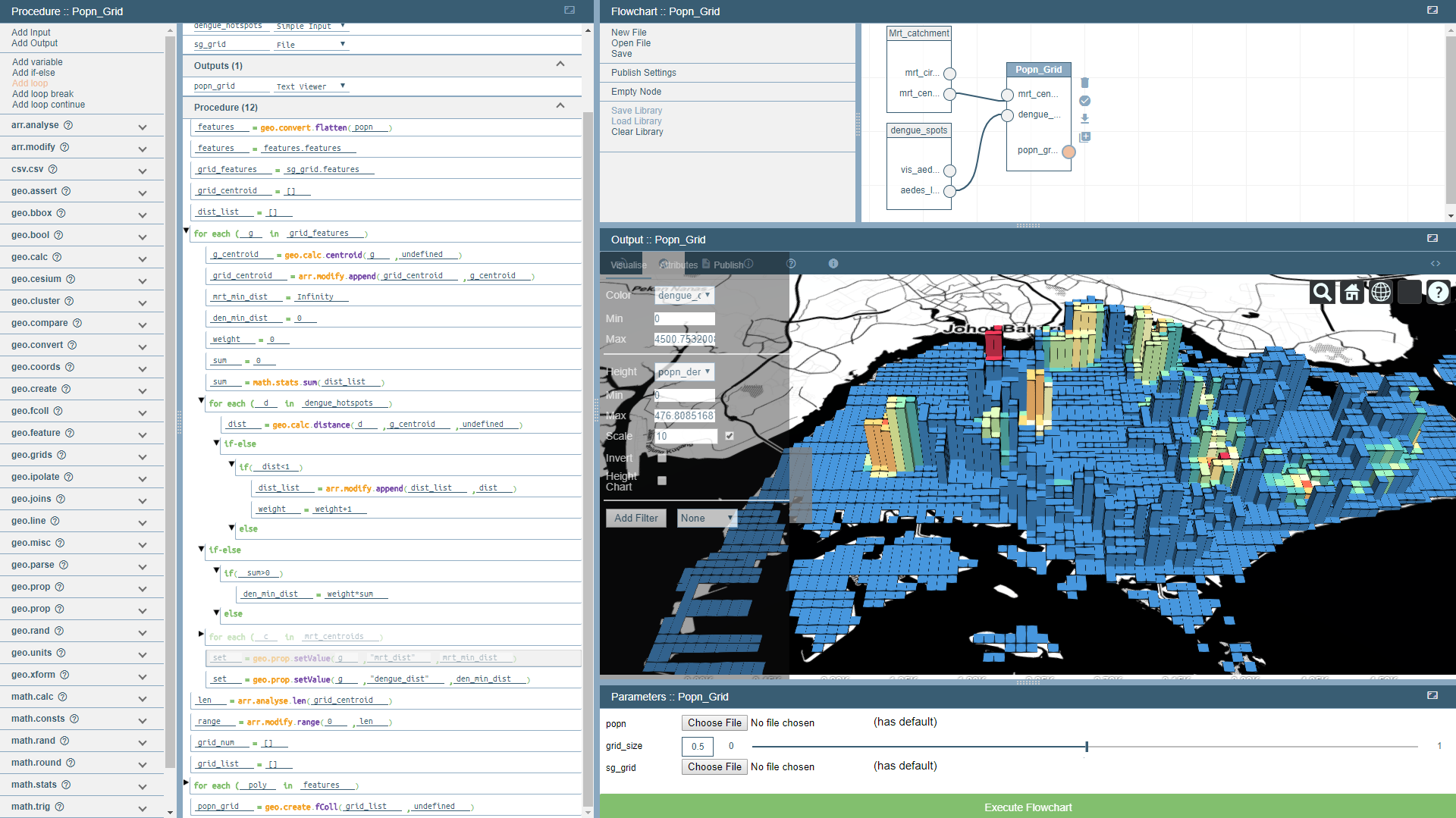
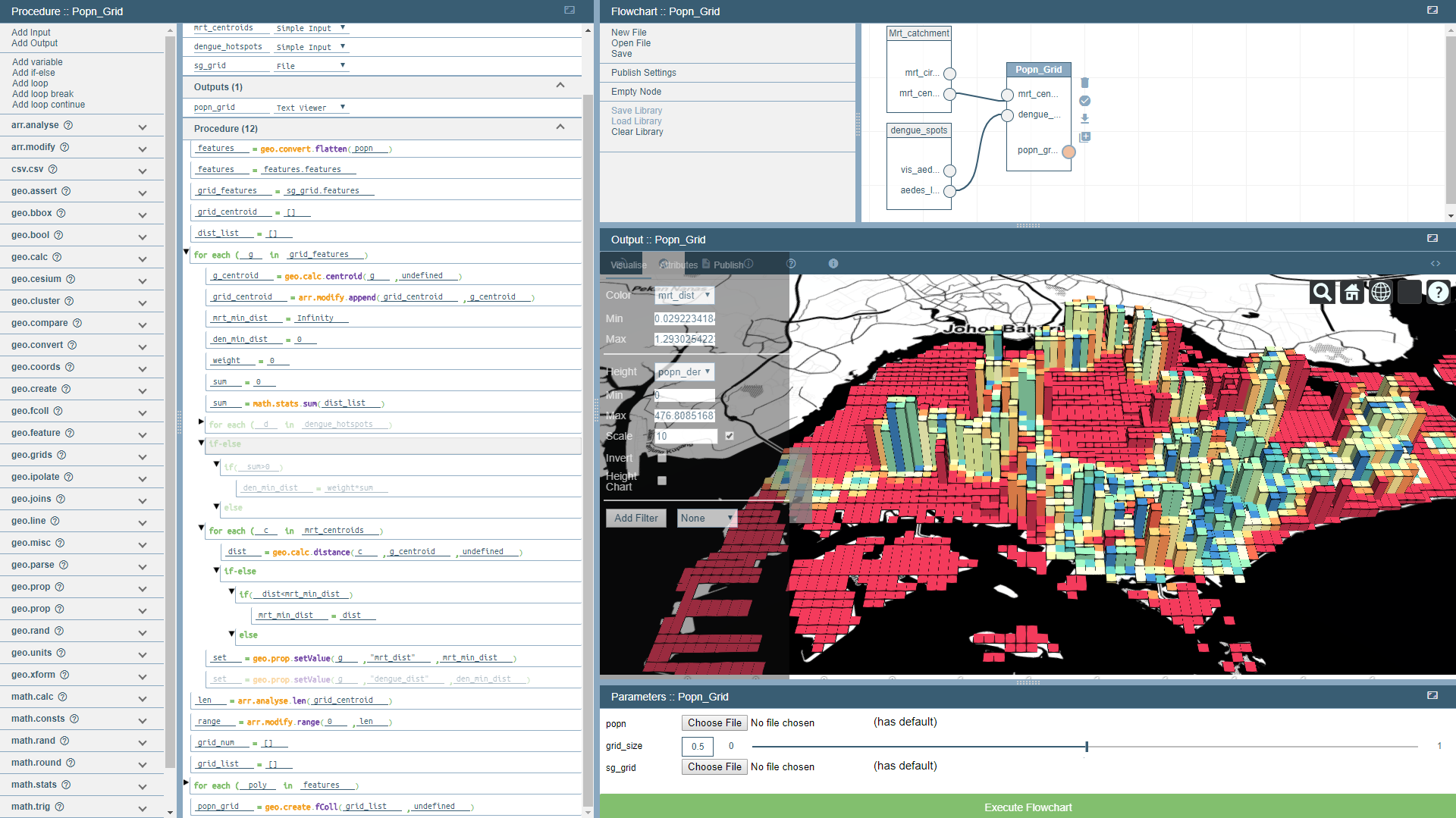
The Möbius Geospatial Modeller allowed geo-computational procedures to be developed for creating interactive 3D geospatial datasets.
Various data types can be manipulated, include both geospatial and non-geospatial data. Procedures can be created to combine and augment these dataset, and to the display the result as a 3D geospatial visualization. Möbius Geospatial uses Cesiumjs as a viewer, and turfjs as a modelling library.
Möbius Geospatial Models can be published as interactive web pages that others can visit and explore. This allows users to develop specific data visualizations and narratives, and to then share these with a wide audience. All without requiring any textual scripting.
Möbius Parametric Modeller, Version 0.2.x
The Möbius Parametric Modeller allows procedures to be developed for generating complex 3D models of buildings and urban neighbourhoods.
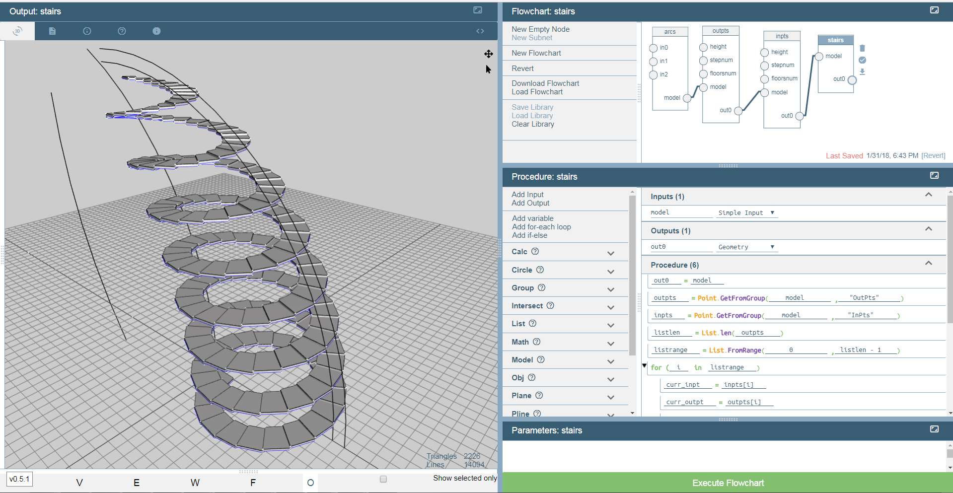
Möbius Modeller Prototype, Version 0.1.x
Möbius Prototype is no longer under development. It is maintained here for historical purposes.
Möbius Prototype tested out the key computational thinking and modelling ideas that were later included in Möbius Geospatial and Möbius Parametric.
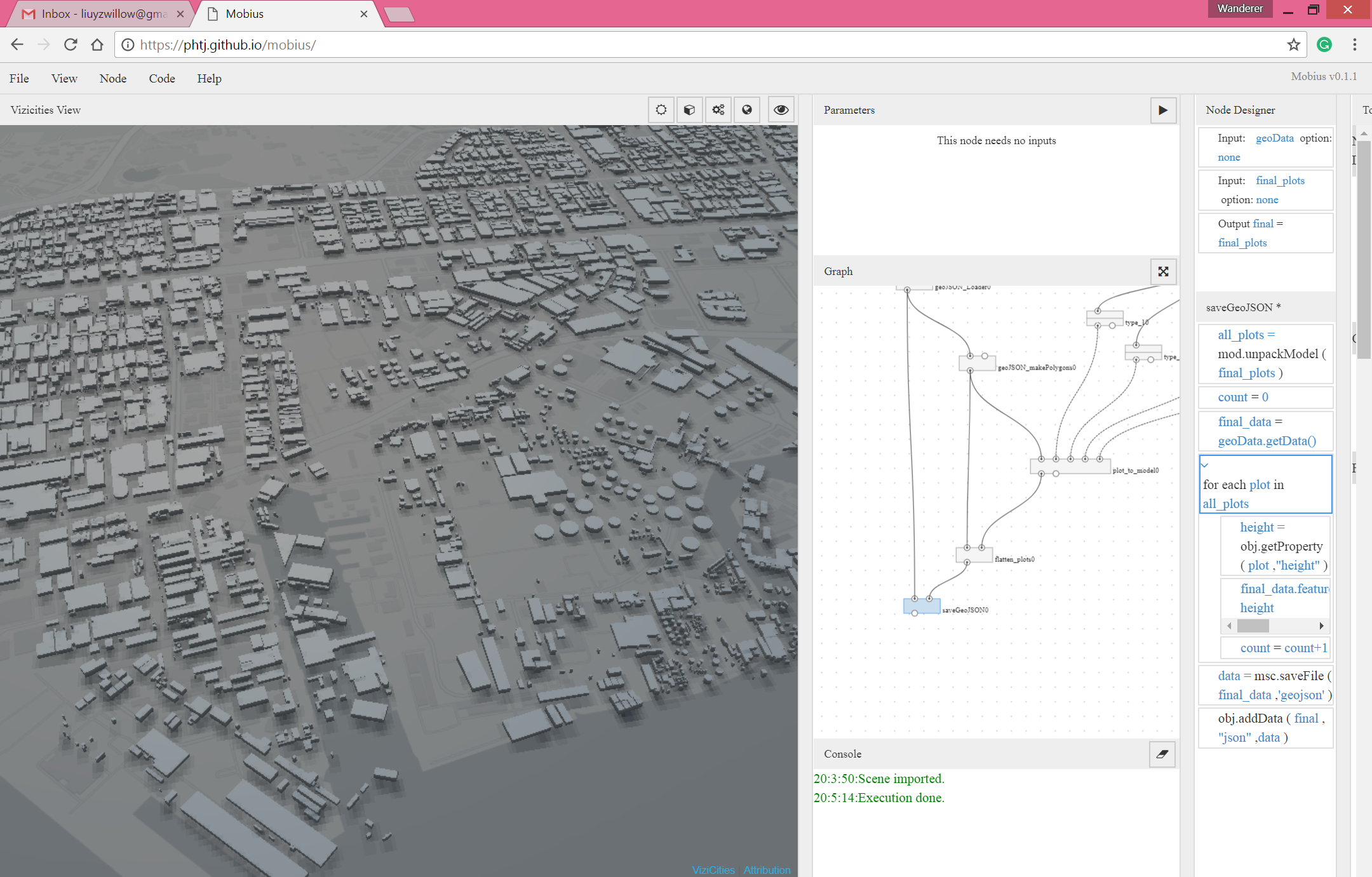
The Modeller also included the ViziCities viewer, developed by Prof Paul Waddell and his team at UC Berkeley. The image below shows the ViziCities viewer integrated into Möbius. The procedure shown on the right loops through the 2D building polygons and adds height information. ViziCities is then use to extrude and render the models.
- Project PI: Patrick Janssen
- Research Project: Nimble BIM
- Lead Developer: Ruize Li
- Research Assistants: Akshata Mohanty
More Links
Möbius Modeller (Version 0.3) (Aug 2017 - Aug 2018)
- Research Project: Smart Design
- Research Project: Computational Thinking
- Lead Developer (2017-2018): Akshata Mohanty
- Research Assistant: Sun Hui Yao
- Student Assistants: Lim Yan Yee Joie, Derek Pung Shuai Shi
- Möbius Parametric Modeller 2 on GitHub
- Möbius YouTube channel
- Try Möbius Parametric Modeller
Möbius Geospatial Modeller (Version 0.2) (Mar 2018 - Dec 2018)
- Research Project: Parametric Urban Modelling for JTC’s Jurong Vision, Phase 2
- Research Project: Smart Design
- Research Project: Computational Thinking
- Research Fellow: Chen Kian Wee
- Lead Developer: Akshata Mohanty
- Research Assistant: Sun Hui Yao
- Student Assistants: Lim Yan Yee Joie, Derek Pung Shuai Shi
- Möbius Geospatial Modeller on GitHub
- Try Möbius Geospatial Modeller
Möbius Modeller Prototype (Version 0.1) (Apr 2015 to Aug 2016)
- Research Project: Nimble BIM
- Lead Developer: Ruize Li
- Research Assistants: Akshata Mohanty
- Möbius Modeller 1 on GitHub
- Try Möbius Modeller 1